Saratoga Wildfire Defense
Saratoga sits at the base of the Santa Cruz Mountains with dense oak and madrone canopy extending into residential neighborhoods. Steep terrain, narrow roads, and proximity to thousands of acres of wildland make it one of the most fire-vulnerable communities in the Bay Area.
Free Wildfire Risk Check for Saratoga
Enter your address to get an instant wildfire risk score, ember exposure analysis, and defensible space recommendations specific to your Saratoga property.
Santa Clara County communities with VHFHSZ designation
Santa Clara County
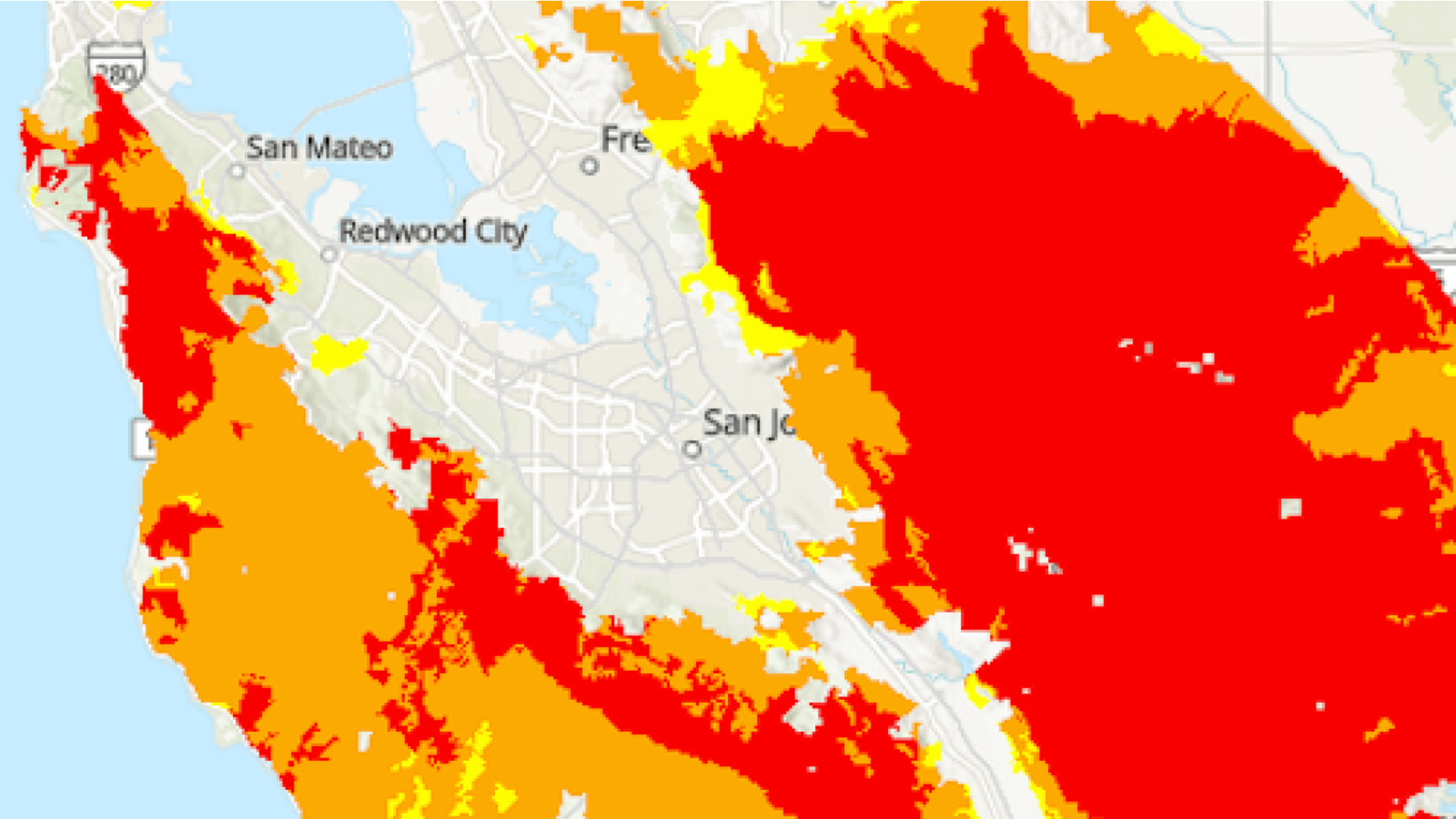
CAL FIRE Very High Fire Hazard Severity Zones (VHFHSZ) shown in red/orange
Source: CAL FIRE Fire Hazard Severity Zone data via Bay Area News Group
CAL FIRE VHFHSZ Designation
One of 6 communities in Santa Clara County with Very High Fire Hazard Severity Zone designations by CAL FIRE. VHFHSZ areas are concentrated in the western foothills and areas bordering Sanborn County Park and the Monte Bello Open Space Preserve.
Saratoga's Wildfire Record
Understanding past fires helps predict future risk. Here are the most significant fire events near Saratoga.
Burned 86,509 acres in Santa Cruz Mountains, threatening Saratoga foothill properties and triggering evacuations.
Burned 4,270 acres and destroyed 132 structures near Summit Road, prompting evacuation warnings for upper Saratoga residents.
Over 13,000 acres burned in the hills above Lexington Reservoir, destroying 42 homes and directly threatening Saratoga neighborhoods.
Local Risk Factors
Steep Canyon Terrain
The western foothills feature steep canyons that channel fire and create dangerous updrafts, accelerating fire spread toward residential areas.
Dense Vegetation Interface
Mature oak, bay laurel, and madrone forests extend directly into neighborhoods with minimal defensible space between wildlands and homes.
Limited Evacuation Routes
Many hillside neighborhoods have single-access roads that can become bottlenecked during evacuations, increasing risk for residents.
Offshore Wind Exposure
Hot, dry offshore winds funnel through mountain passes and can push fire rapidly into developed areas.
Saratoga Fire Environment
Vegetation Types
Wind Patterns
Seasonal offshore winds (NE) in fall; sea breeze (W) in summer
Topography
Elevation ranges from 400 ft to 2,600 ft. Steep west-facing slopes create fire chimneys.
Fire District
Saratoga Fire District, Station 1
Insurance Impact
Multiple major insurers have non-renewed policies in upper Saratoga since 2019. FAIR Plan enrollments have increased significantly in Santa Clara County's WUI zones.
Protecting Your Saratoga Home & Family
Living in a fire-prone area means being proactive. Here are the steps every Saratoga homeowner should take to protect their property and prepare for wildfire season.
Evacuation Planning
Many Saratoga hillside neighborhoods have single-access roads. Know your evacuation zone via Zonehaven and register for AlertSCC emergency notifications. Keep your vehicle fueled and a go-bag packed during fire season.
Defensible Space
Saratoga WUI residents can receive free Home Ignition Zone inspections and up to $10,000 in structure hardening rebates through the Santa Clara County FireSafe Council. Clear vegetation within 5 feet of your home and maintain lean landscaping out to 100 feet.

Defensible Space: Creating a lean, clean zone around your home is your first line of defense.
Source: Risk Strategies
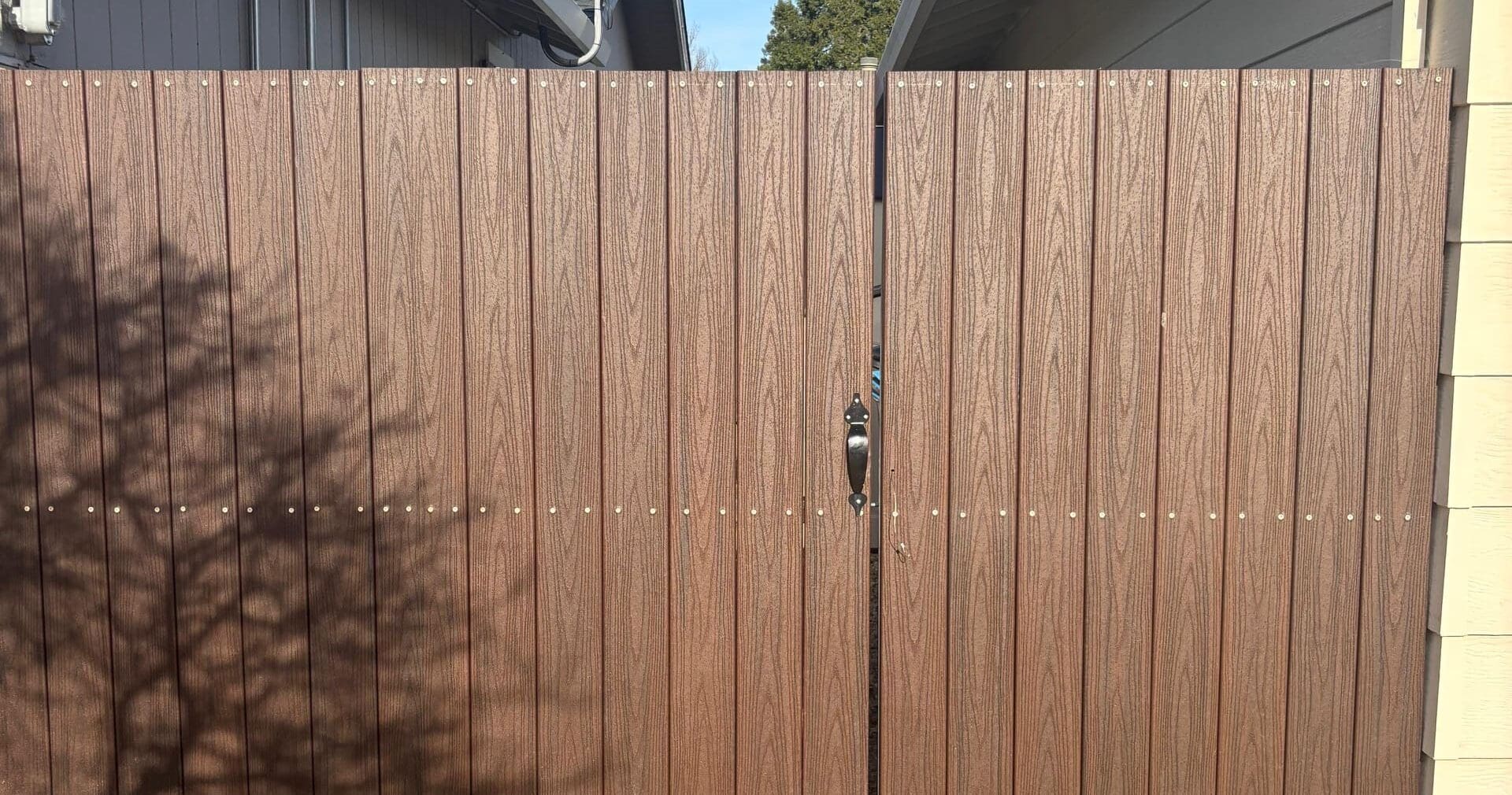
Home Hardening: Non-combustible fencing and fire-resistant materials prevent ember ignition.
Source: Fire Safe Marin
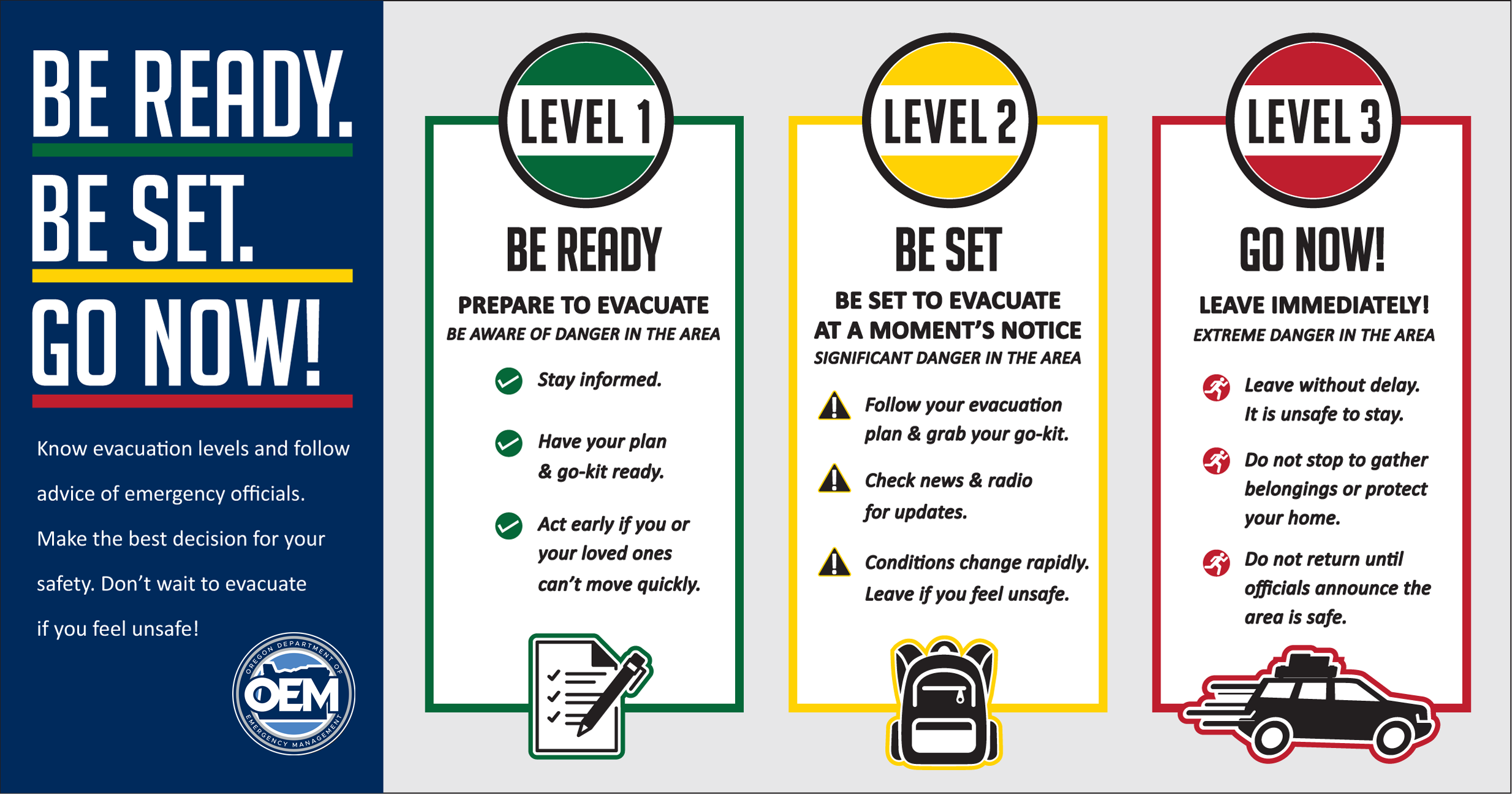
Evacuation Planning: Know your zone, know your routes, and leave early when warnings are issued.
Source: Oregon Wildfire Response

Go-Bag: Keep a packed emergency bag in your vehicle during fire season with essentials for 72 hours.
Source: AARP
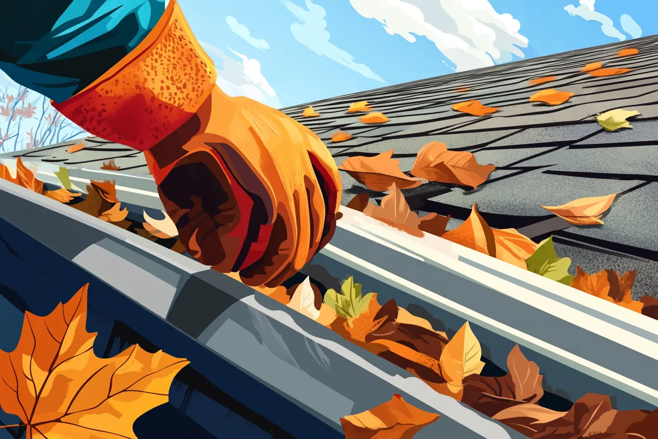
Roof & Gutter Maintenance: Clean gutters and Class A roofing materials dramatically reduce ember ignition risk.
Source: RallyBacks
Your Local Fire Safe Council
Santa Clara County FireSafe Council
The Santa Clara County FireSafe Council offers free resources, community chipping programs, home assessments, and education to help Saratoga residents reduce wildfire risk and prepare for fire season.
Visit Santa Clara County FireSafe CouncilSaratoga Wildfire Preparedness Resources
Santa Clara County FireSafe Council
Free chipping, HIZ inspections, defensible space assistance, and structure hardening rebates for Saratoga WUI residents.
SCC FireSafe CouncilAlertSCC Emergency Notifications
Register for Santa Clara County emergency alerts including evacuation orders and wildfire warnings.
Santa Clara County OESCAL FIRE Defensible Space Guide
Official California guide to creating defensible space zones around your property.
CAL FIREProtect Your Saratoga Home with FireRoofs
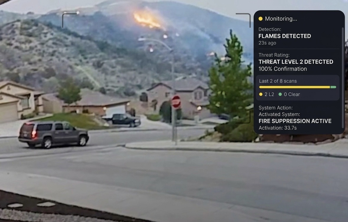
Defensible space and evacuation planning are essential — but they have limits. When embers are raining down and flames are approaching, you need an automated defense system that activates whether you're home or away.
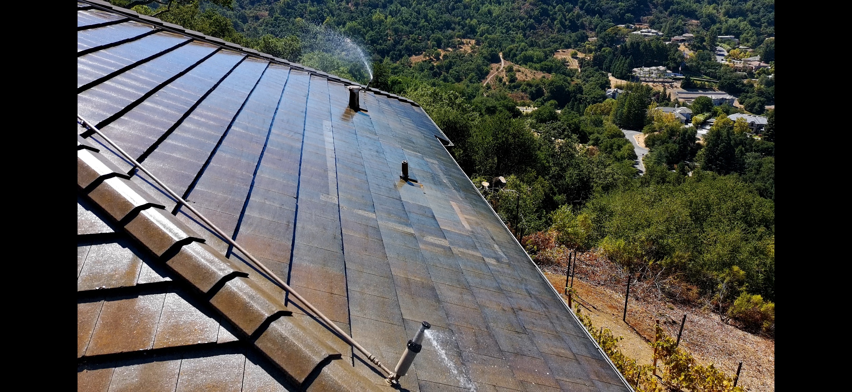
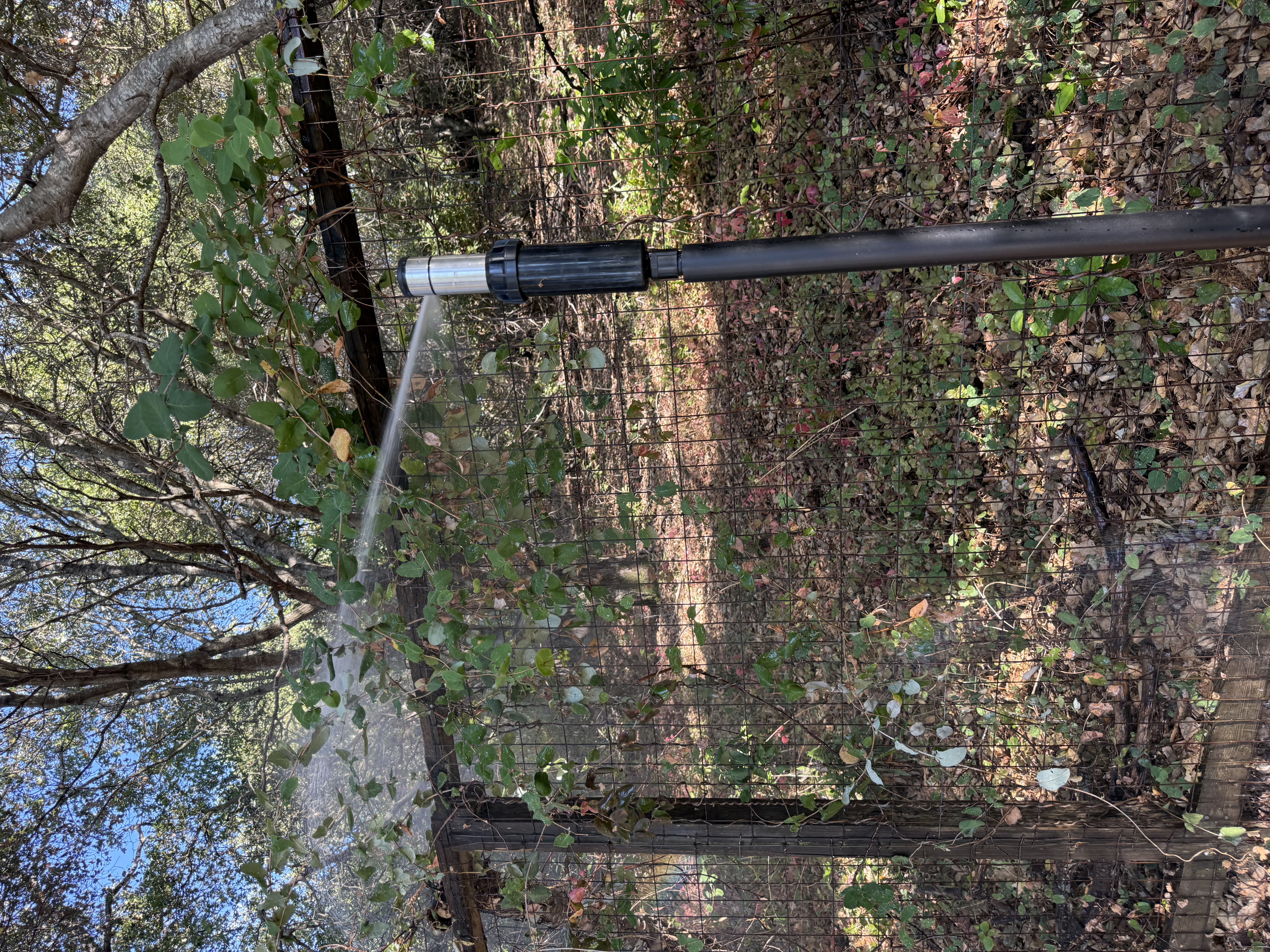
FireRoofs installs custom-built exterior sprinkler systems designed specifically for Saratoga's terrain and vegetation. Our three-stage Detect → Alert → Defend system uses intelligent wildfire detection cameras, satellite monitoring, and high-pressure water to saturate your property and create a defensible perimeter around your home.
- Roof sprinklers reach 20 feet past the roofline
- Perimeter sprinklers soak vegetation up to 35 feet out
- Automatic activation via intelligent detection. No manual intervention needed
- Class A firefighting foam available as an add-on for enhanced protection
- Starlink satellite internet and backup generator recommended for off-grid reliability
Explore Nearby Communities
2026 Insurance Alert for Saratoga Homeowners
Homeowners in Saratoga are facing surging FAIR Plan rates and non-renewals from private carriers. California's Safer from Wildfires framework now requires participating insurers to offer discounts for documented mitigation systems. FireRoofs provides the engineering documentation and evidence packet designed to help you qualify for the voluntary market.
Request a Free Property EvaluationProtect Your Saratoga Property Today
Every Saratoga property is different. Get a free evaluation of your home's wildfire exposure and a custom defense plan.