Aptos Wildfire Defense
Aptos is a coastal community with neighborhoods extending into the forested hills of the Santa Cruz Mountains. The blend of coastal climate and mountain terrain creates unique fire challenges, especially during offshore wind events that override marine influence.
Free Wildfire Risk Check for Aptos
Enter your address to get an instant wildfire risk score, ember exposure analysis, and defensible space recommendations specific to your Aptos property.
CAL FIRE Risk Designation
Santa Cruz County
CAL FIRE Very High Fire Hazard Severity Zones (VHFHSZ) shown in red/orange
Source: CAL FIRE Fire Hazard Severity Zone data via Bay Area News Group
CAL FIRE VHFHSZ Designation
Portions of the greater Aptos area fall within CAL FIRE Fire Hazard Severity Zones, with risk increasing in hillside neighborhoods above Soquel Drive.
Aptos's Wildfire Record
Understanding past fires helps predict future risk. Here are the most significant fire events near Aptos.
Burned extensively through the Santa Cruz Mountains, with some Aptos neighborhoods under mandatory evacuation.
Burned 7,817 acres north of Aptos in Bonny Doon, requiring multi-agency response.
Burned 399 acres in nearby Boulder Creek, demonstrating continued risk in the mountain corridor.
Local Risk Factors
Mountain-to-Coast Transition
Properties transition from coastal climate to mountain forest within a few miles, creating varied and unpredictable fire conditions.
Redwood-Chaparral Mix
The combination of redwood forest (slow-burning) and chaparral (fast-burning) creates complex fire behavior.
Post-CZU Landscape
Areas burned in 2020 are regenerating with fire-prone brush and grass, potentially increasing short-term risk.
Climate Change Impact
Longer, hotter fire seasons are pushing fire risk closer to the coast than historically observed.
Aptos Fire Environment
Vegetation Types
Wind Patterns
Marine layer provides some protection; offshore winds can override coastal cooling
Topography
Elevation from sea level to 1,500 ft. Steep, forested canyons above coastal terraces.
Fire District
Aptos/La Selva Fire District
Insurance Impact
Post-CZU fire, Aptos homeowners in hillside areas have experienced significant insurance challenges with non-renewals and rate increases.
Protecting Your Aptos Home & Family
Living in a fire-prone area means being proactive. Here are the steps every Aptos homeowner should take to protect their property and prepare for wildfire season.
Evacuation Planning
Aptos ridge communities have limited roads. Register for CruzAware alerts and know your Zonehaven evacuation zone. During the CZU Lightning Complex, Aptos neighborhoods saw evacuation warnings. early departure is critical in these narrow canyons.
Defensible Space
Dense redwood and mixed-evergreen forest in the Aptos hills requires year-round vegetation management. Clear brush and dead limbs within 100 feet of your home. Remove any stored firewood or lumber from within 30 feet of structures.
Defensible Space: Creating a lean, clean zone around your home is your first line of defense.
Source: Risk Strategies
Home Hardening: Non-combustible fencing and fire-resistant materials prevent ember ignition.
Source: Fire Safe Marin
Evacuation Planning: Know your zone, know your routes, and leave early when warnings are issued.
Source: Oregon Wildfire Response

Go-Bag: Keep a packed emergency bag in your vehicle during fire season with essentials for 72 hours.
Source: AARP

Roof & Gutter Maintenance: Clean gutters and Class A roofing materials dramatically reduce ember ignition risk.
Source: RallyBacks
Your Local Fire Safe Council
Fire Safe Council of Santa Cruz County
The Fire Safe Council of Santa Cruz County offers free resources, community chipping programs, home assessments, and education to help Aptos residents reduce wildfire risk and prepare for fire season.
Visit Fire Safe Council of Santa Cruz CountyAptos Wildfire Preparedness Resources
Fire Safe Council of Santa Cruz County
Community wildfire preparedness programs, fuel reduction, and Firewise community support for Aptos.
FSCSCCSanta Cruz County Wildfire Resources
County resilience resources including evacuation planning and wildfire recovery information.
Santa Cruz CountyCAL FIRE Defensible Space Guide
Official zone-by-zone guide for creating defensible space around your home.
CAL FIREProtect Your Aptos Home with FireRoofs
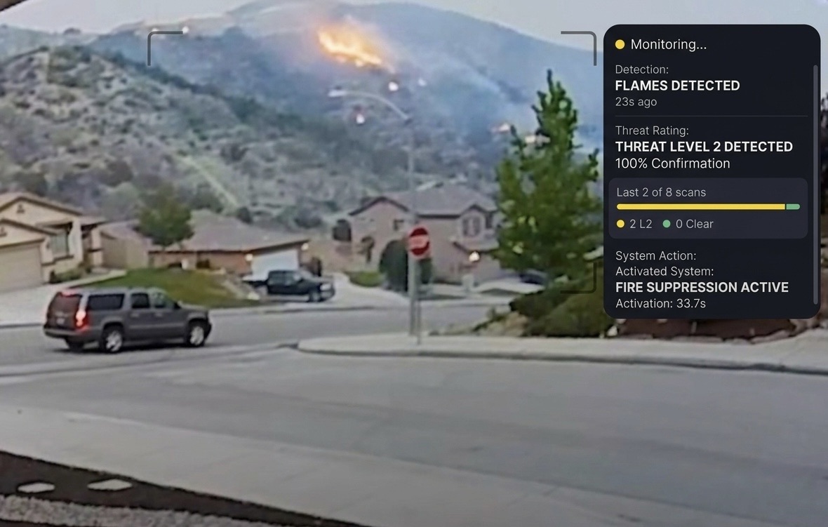
Defensible space and evacuation planning are essential — but they have limits. When embers are raining down and flames are approaching, you need an automated defense system that activates whether you're home or away.
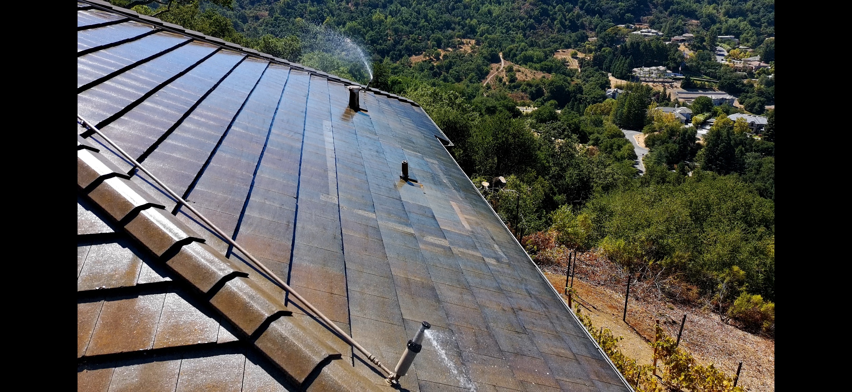
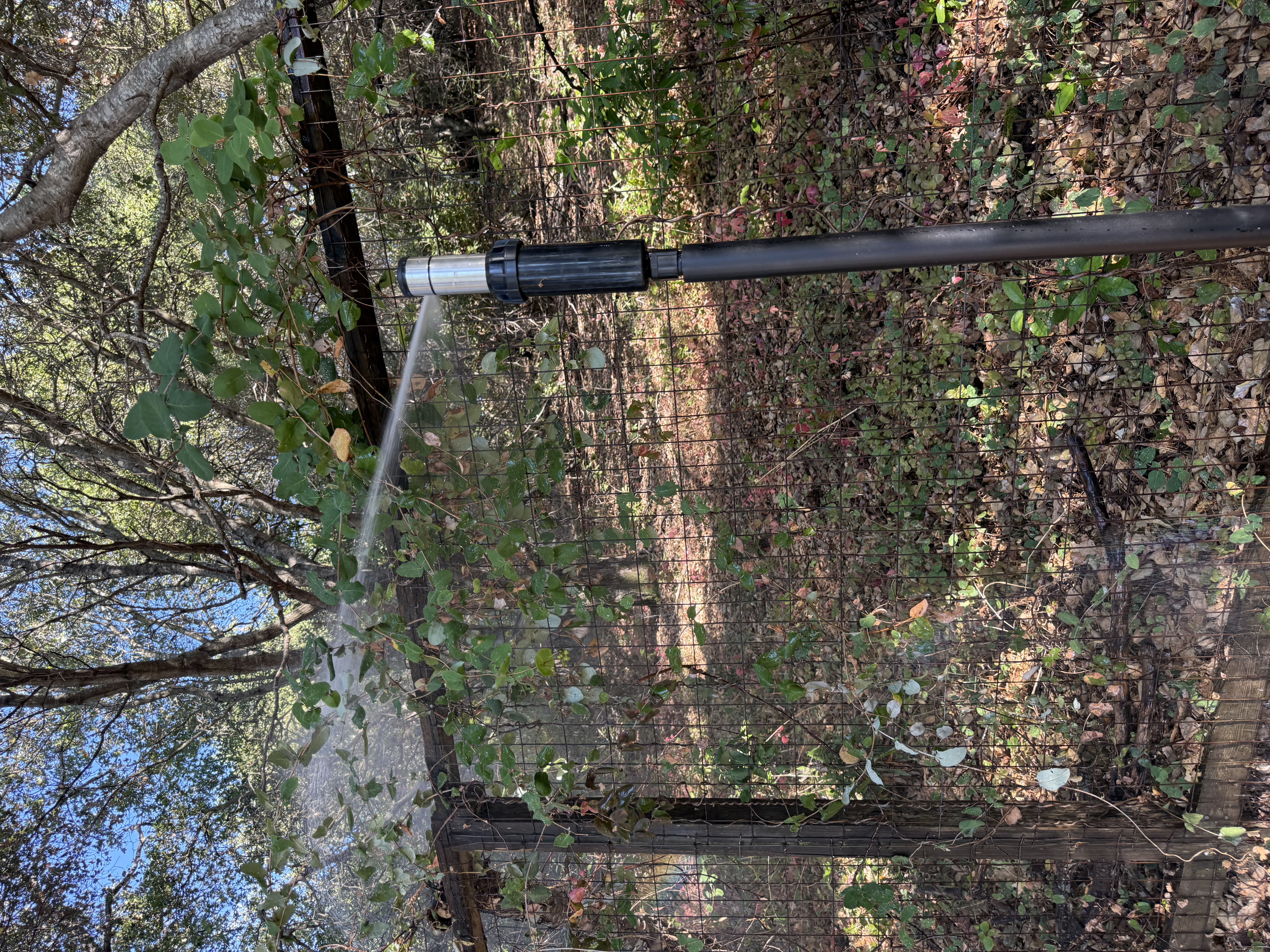
FireRoofs installs custom-built exterior sprinkler systems designed specifically for Aptos's terrain and vegetation. Our three-stage Detect → Alert → Defend system uses intelligent wildfire detection cameras, satellite monitoring, and high-pressure water to saturate your property and create a defensible perimeter around your home.
- Roof sprinklers reach 20 feet past the roofline
- Perimeter sprinklers soak vegetation up to 35 feet out
- Automatic activation via intelligent detection. No manual intervention needed
- Class A firefighting foam available as an add-on for enhanced protection
- Starlink satellite internet and backup generator recommended for off-grid reliability
Explore Nearby Communities
2026 Insurance Alert for Aptos Homeowners
Homeowners in Aptos are facing surging FAIR Plan rates and non-renewals from private carriers. California's Safer from Wildfires framework now requires participating insurers to offer discounts for documented mitigation systems. FireRoofs provides the engineering documentation and evidence packet designed to help you qualify for the voluntary market.
Request a Free Property EvaluationProtect Your Aptos Property Today
Every Aptos property is different. Get a free evaluation of your home's wildfire exposure and a custom defense plan.